Drone aerial imaging and mapping services
SK Drones offers comprehensive and high-quality drone aerial imaging and mapping services to meet a wide range of needs.
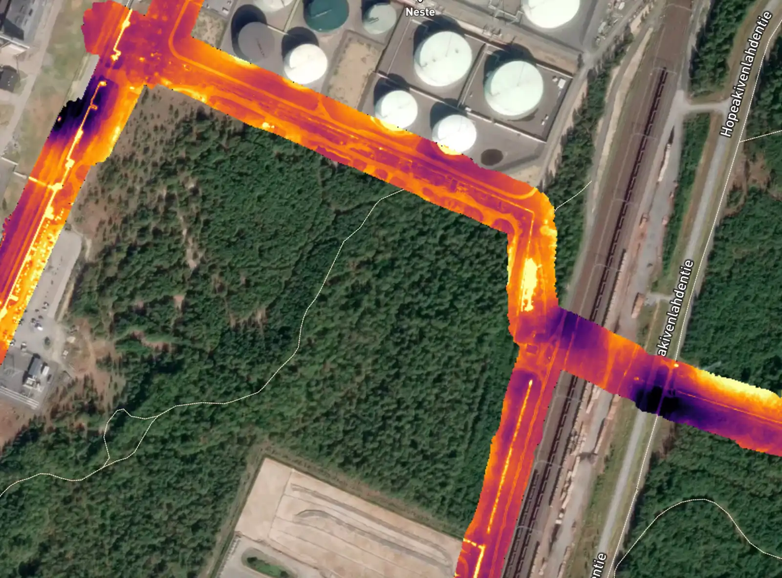
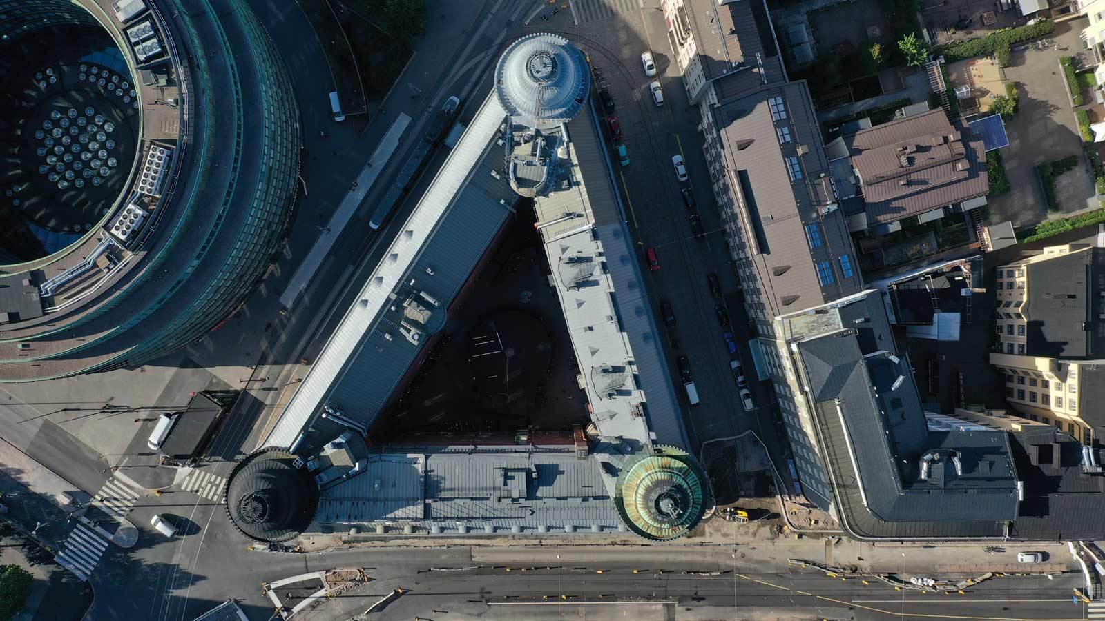
Through us, you can obtain, among other things, dimensionally accurate photogrammetric 3D models, point clouds, georeferenced orthophotos, thermal imaging (including buildings, structures, and district heating networks), drone-based laser scanning, and consulting services. We inspect, among other things, infrastructure owned by energy companies and report our findings using advanced software, making continuous monitoring easy for the client.

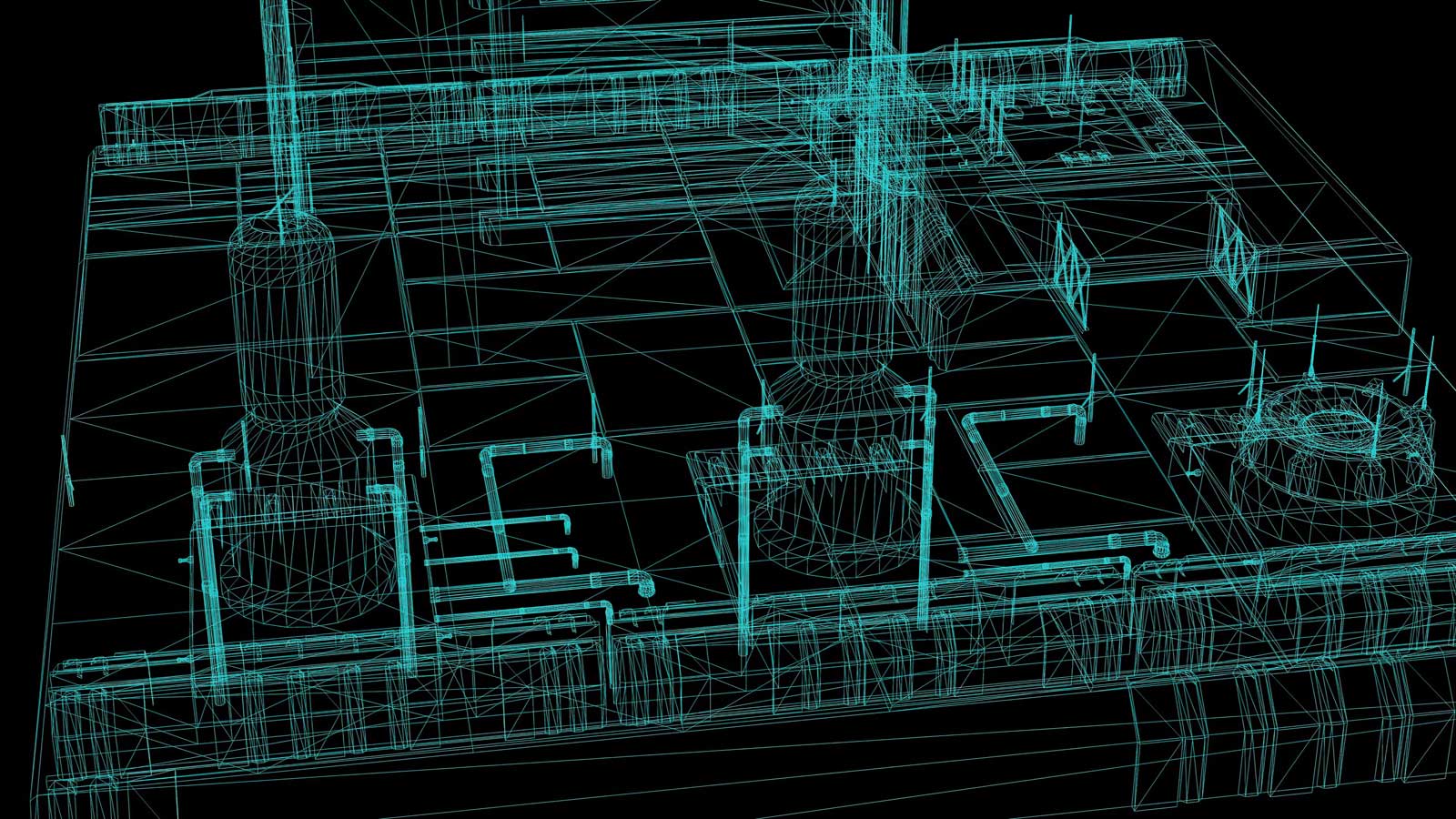
3D models / point clouds
We create accurate three-dimensional models of terrain, buildings, and infrastructure using photogrammetry and laser scanning. Our models are available as georeferenced (tied to map coordinate systems), which allows, for example, point cloud data to be used in the design phase with absolute accuracy in the local project coordinate system.
These models can be utilized when producing information models compliant with the 2025 Building Act, for example in renovation and refurbishment projects.

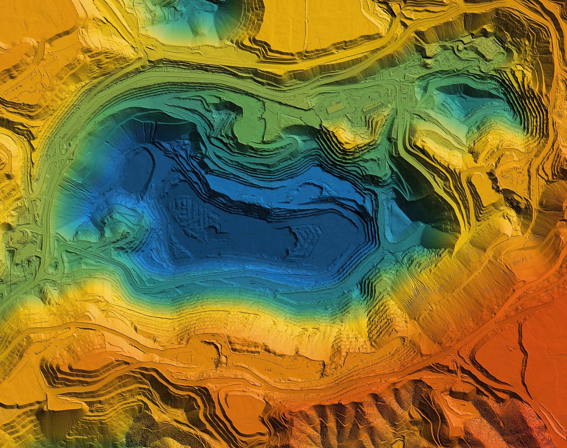
Mapping
We map even large areas quickly and cost-effectively using drones, from which we generate a terrain model. We produce orthophotos and point clouds as base data for, for example, new wind power projects, solar panel fields, and other large-scale infrastructure projects. Designers have access to up-to-date information about the terrain of the area.
Project monitoring
Monitoring of new construction projects from the project planning phase through to completion. We document and map the construction site at an agreed frequency from start to finish. With the platform we provide, data analysis is lightweight and cost-effective throughout the entire construction project. You can also upload design drawings and other documents into the software, making it easy to track project progress and quickly detect possible errors. All photo and video data collected during the construction phase is also stored for later review.
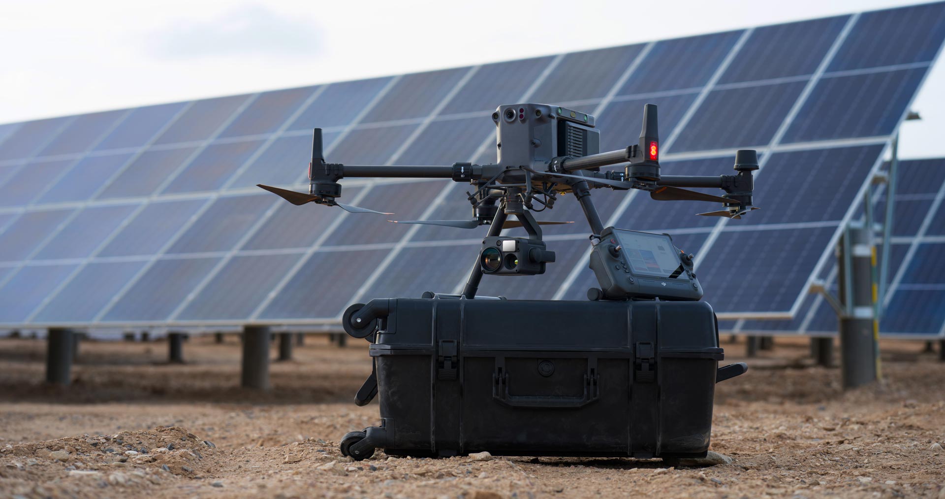
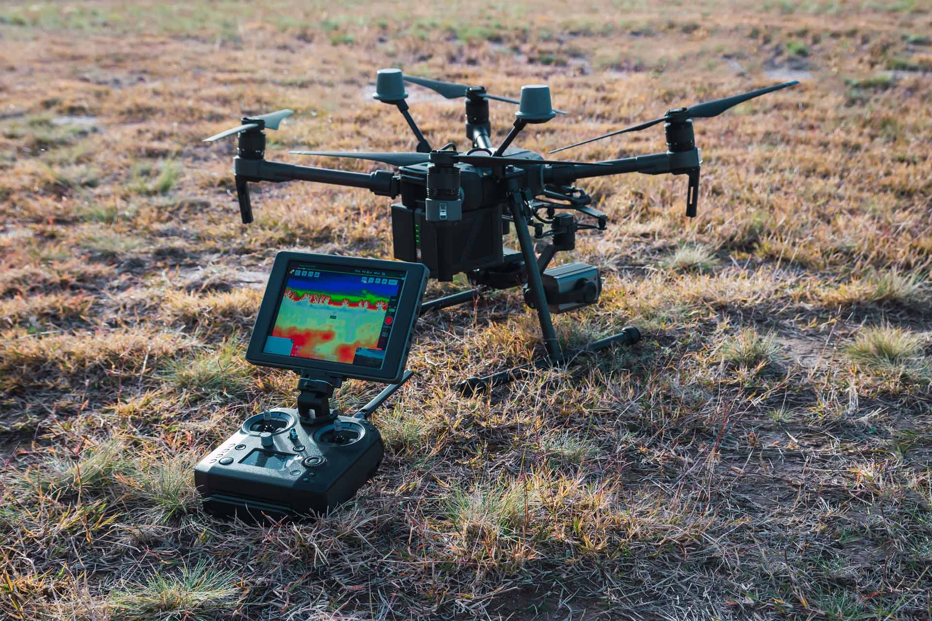
Drone thermal camera
A high-precision thermal camera combined with the latest drone technology provides accurate data for detecting various heat transfer anomalies. With drones, large and hard-to-reach areas can be inspected precisely and safely. The accuracy of thermal images and videos is excellent. We also create orthophotos from thermal imagery, which makes inspection and analysis of district heating lines, for example, easy and precise.
Drone laser scanning
With laser scanning, we can capture hard-to-access sites as well as targets requiring exceptionally high-precision data safely and efficiently. If the need is, for example, to distinguish power lines or small details from a point cloud, laser scanning is the right choice for data collection.

Consulting
We help companies utilize drone technology according to their needs. Through us, you receive all necessary support from equipment to software, as well as solutions for leveraging drone technology for your company’s requirements.
Contact us
Would you like more information about our services? Feel free to contact our team.
References