Drone Thermal Camera
We offer high-quality drone thermal imaging that combines cutting-edge technology and expertise to provide our clients with detailed, reliable, and accurate data. Our experienced drone operators are trained and certified, and they use the latest drone technology to ensure the best possible results for every client.
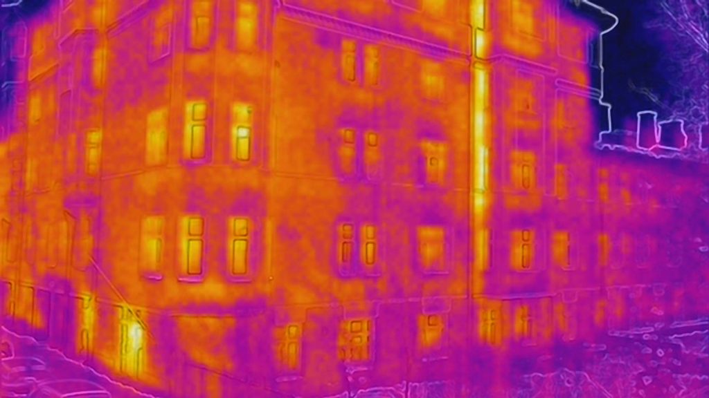
Use cases
Drone thermal imaging is a versatile service that can be used in many different fields. Below are some of the most common use cases:
- Construction industry and property management:
- Detect heat leaks, moisture, and structural defects
- Inspect roofs, walls, and other structures safely and efficiently
- Monitor and assess building energy efficiency
- Energy sector:
- Monitor and maintain solar panel systems, wind turbines, and other energy sources
- Identify equipment faults and maintenance needs
- Agriculture:
- Analyze crop health and water needs
- Detect diseases and pest infestations
- Search and rescue operations:
- Search for missing persons in hard-to-reach terrain
- Assess accident site safety and damage
- Environmental monitoring:
- Monitor forests and other natural areas
- Identify large-scale environmental changes
Benefits
- Accuracy and reliability: Drone thermal imaging provides precise and detailed information for informed decision-making.
- Cost-effectiveness: Reduces the need for manual work, time, and resources, saving money.
- Safety: Enables inspection of difficult and hazardous areas while minimizing risks.
- Speed: Collects and analyzes data quickly, enabling real-time decision-making.
- Environmental friendliness: Reduces carbon footprint and environmental impact by minimizing the need for physical presence and transport.
Contact us today so we can tailor a drone thermal imaging solution specifically for your needs and help you achieve your project goals efficiently and safely!
Frequently Asked Questions
What does drone thermal camera imaging mean?
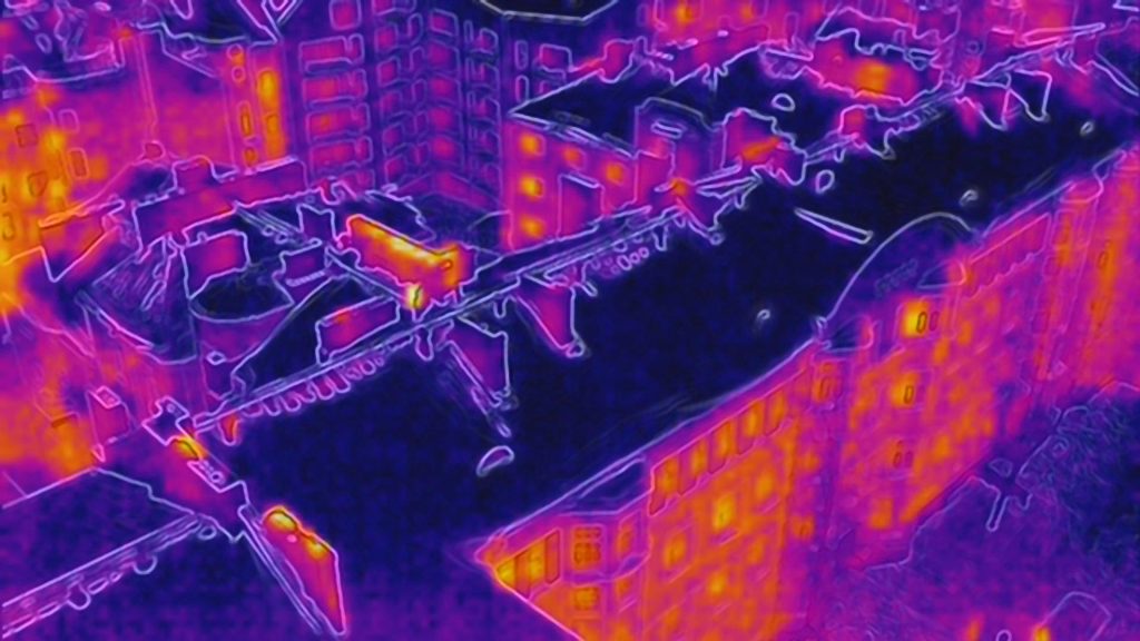
Drone thermal imaging uses an infrared camera to measure the surface temperature of a target and produce a thermal image that reveals heat leaks, moisture damage, and structural anomalies that are invisible to the naked eye.
Where does SK Drones offer thermal imaging?
We provide drone thermal imaging across Finland. We have pilots in Helsinki, Tampere, Jyväskylä and Oulu, and we also carry out projects outside these cities as well as within the EU when needed.
Who is drone thermal imaging suitable for?
The service is especially suited for the construction and property management sector for inspecting roofs, walls and structures, the energy sector for monitoring solar panels and wind turbines and detecting faults, search and rescue operations in hard-to-reach areas, and environmental monitoring.
What can thermal imaging detect?
Thermal imaging can detect heat leaks, moisture and water damage, structural defects, faulty solar panels or other equipment, and deviations in a building’s energy efficiency.
When is thermal imaging worth doing?
The best results are usually achieved when there is a clear temperature difference between the target and its surroundings – for example at dawn or dusk, or during seasons when temperature differences are more pronounced.
What are the benefits of drone thermal imaging compared to traditional inspection methods?
Compared with traditional, often manual inspections, drone thermal imaging is faster, safer for hard-to-reach or high locations, and produces accurate, documented data to support decision-making – while also reducing the need for manual labor and therefore costs.
How long does a thermal imaging project take?
The flight itself usually takes a few hours to a day depending on the size of the site, and the analyzed report is typically delivered within a few business days of the flight.
How much does drone thermal imaging cost?
Pricing depends on the size and location of the site and the scope of analysis required. We always provide a free, project-specific quote before starting.
Does SK Drones have the necessary permits for thermal imaging?
Yes. SK Drones has operated under Traficom’s Specific Category authorization (SORA methodology) since 2018, allowing safe and compliant flight operations even in more demanding locations.
Contact us
Would you like more information about our services? Feel free to contact our team.
References